


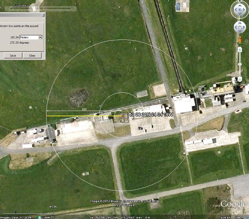
WMO03502, Aberporth
52 08 22N 04 34 16W
Altitude 133 metres
Estimated Class 3/5, dependent on shadow. [update] forgot to look, marked as climatic, although I don’t recall this on major lists[/update]
UHI, local hard ground cover. Site unstable, buildings appearing and disappearing.
.

It’s just a windy site to provide local conditions for the range. Or at least it was when I was deployed there in the 1980’s