


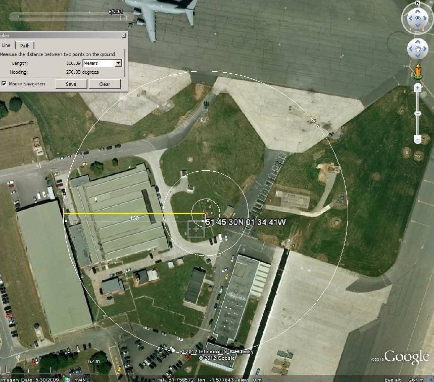
WMO03649, Brize Norton (RAF Brize Norton)
51 45 30N 01 34 41W
Altitude 88 metres.
Estimated Class 3, fails Class 2 on >10% hardstanding within 30 metres.
UHI, heavy usage airbase, taxiways, aprons, runways, buildings, base village and see supplementary, distance, none.

Left circa 2006, right circa 2009. (no image shift even if is looks as though there is)
Intense long distance RAF transport, Iraq, Afghanistan have led to rapid infrastructure changes without the time to sort out things like met enclosures.
A similar situation has existed at other major bases at times of conflict, including the Cold War. Some of those sites are climatic, compromised by a lack of time for proper met station moves. Brize Norton met is not so far as I know climatic, just local conditions… to the aerodrome.
This site might to a candidate to see if the above visual changes are reflected in data.
